
Redefining Spatial Intelligence Through Aerial Innovation
Spatial Transition Technologies Ltd. (STT Drones) is a global provider of professional unmanned aerial systems. Since 2018, we have been delivering enterprise-grade drone solutions across agriculture, infrastructure inspection, aerial cinematography, and public safety — empowering industries to work smarter, safer, and more efficiently.
80+
Countries & Regions
30K+
Enterprise Clients
12+
Patents & Certifications
99.5%
Mission Success Rate
Industry Landscape
A Rapidly Evolving Market
The global commercial drone market is projected to exceed USD 110 billion by 2030, driven by advances in AI, sensor technology, and regulatory frameworks. From precision agriculture covering over 30% of large farms worldwide, to autonomous infrastructure inspections reducing costs by up to 70%, drones are transforming how industries operate. STT Drones is positioned at the forefront of this transformation.
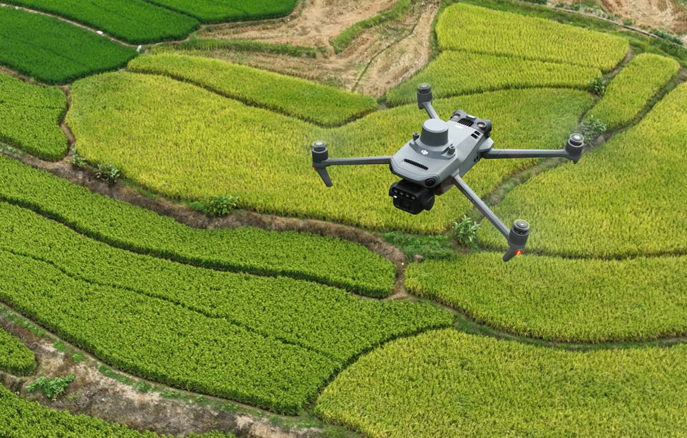
Precision Agriculture
Multispectral imaging, crop health monitoring, and intelligent spraying systems that help farmers increase yields by up to 30% while reducing chemical usage.
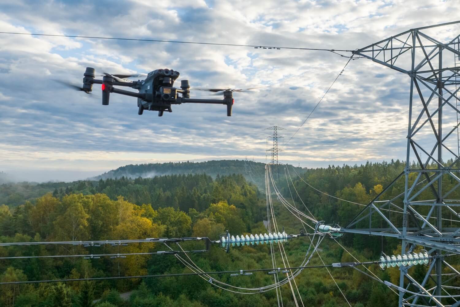
Infrastructure Inspection
Autonomous inspection of power lines, wind turbines, bridges, and pipelines — reducing human risk and cutting inspection costs by up to 70%.
Aerial Photography & Film
4K/8K cinematic aerial footage with 3-axis stabilized gimbals, enabling filmmakers and content creators to capture breathtaking perspectives.
Public Safety & Emergency
Thermal imaging search and rescue, disaster assessment, and real-time situational awareness for first responders and law enforcement agencies.
Our Journey
From Vision to Global Impact
Company Founded
Spatial Transition Technologies Ltd. established in Shenzhen, China — the global hub of drone manufacturing and innovation.
First Product Line
Launched the STT Phantom series for professional aerial photography, quickly gaining recognition in the Southeast Asian market.
Enterprise Expansion
Entered the agricultural drone market with precision spraying solutions, serving over 5,000 farms across Asia-Pacific.
Global Distribution
Established partnerships with distributors in 50+ countries, expanding into infrastructure inspection and public safety sectors.
AI Integration
Integrated AI-powered autonomous flight, obstacle avoidance, and real-time data analytics into our enterprise drone platform.
Next Generation
Launching the STT Pro series with swarm intelligence, edge AI processing, and extended 60-minute flight time capabilities.
Our Mission
Bridging the Gap Between Sky and Ground
At STT Drones, our mission is to make professional-grade aerial technology accessible and reliable for every industry. We believe drones are not just flying machines — they are spatial data platforms that transform how businesses gather intelligence, monitor assets, and make decisions.
The commercial drone industry is undergoing a paradigm shift. With AI-powered autonomy, edge computing, and multi-spectral sensing becoming standard capabilities, drones are evolving from remote-controlled tools into intelligent autonomous systems. STT Drones is committed to leading this evolution.
Our product lines span from consumer-grade aerial photography drones to enterprise-level agricultural spraying systems and industrial inspection platforms. Each product is engineered with our proprietary flight control algorithms, ensuring stable performance in challenging environments — from high-altitude mountain surveys to offshore wind farm inspections.
Core Values
What Drives Us Forward
Technology-Driven
We invest over 20% of annual revenue in R&D, developing proprietary flight controllers, AI algorithms, and sensor fusion technologies.
Safety First
Every drone undergoes 200+ hours of rigorous testing. Our multi-redundancy systems and fail-safe protocols ensure mission-critical reliability.
Customer-Centric
From pre-sales consultation to post-sales support, we provide end-to-end solutions tailored to each industry's unique operational requirements.
Sustainable Innovation
Committed to reducing carbon footprint through energy-efficient motors, recyclable materials, and drone-based environmental monitoring solutions.
Technology Edge
Engineering Excellence
Our drones integrate the latest advances in autonomous flight, sensor fusion, and edge AI — delivering unmatched performance for professional applications.
AI-Powered Autonomy
Onboard neural networks enable real-time obstacle avoidance, intelligent path planning, and automated mission execution without GPS dependency.
Extended Endurance
Advanced lithium-polymer battery systems with intelligent power management deliver industry-leading flight times of up to 60 minutes per charge.
Multi-Spectral Imaging
Integrated NDVI, thermal, and RGB sensors provide comprehensive data for agriculture, inspection, and environmental monitoring applications.
Long-Range Transmission
Proprietary OcuSync link technology ensures stable HD video transmission up to 20km with ultra-low latency for beyond-visual-line-of-sight operations.
Swarm Intelligence
Coordinate multiple drones for large-scale mapping, search operations, and agricultural spraying — maximizing coverage and operational efficiency.
Enterprise SDK
Open API and SDK platform allows enterprise customers to integrate drone data into existing workflows, ERP systems, and analytics dashboards.
Ready to Elevate Your Operations?
Whether you need a professional aerial photography drone or a complete enterprise fleet solution, our team is ready to help.